The Dumat al-Jandal Oasis: A Natural Cistern the Size of a Town
Short answer
Dumat al-Jandal sits at the southern end of Wadi Sirhan in a V-shaped limestone depression roughly 8 by 6 km, which recharged the aquifer that fed the oasis. It was a succession of walled mud-brick villages, with a first-century AD wall about five metres high and an old quarter built on foundations of the mid-first millennium BC.
Key takeaways
- ✓The oasis sits at the southern end of Wadi Sirhan in a V-shaped depression of roughly 8 by 6 kilometres, ringed by low limestone hills.
- ✓That shape is the point: a limestone depression collects and holds water underground. It is a natural cistern the size of a town.
- ✓It stands isolated north of the Nafud desert at the meeting of major caravan routes. Water, in isolation, on a crossroads.
- ✓It was not one city but a succession of villages, each a cluster of flat-roofed mud-brick houses inside its own circular wall.
- ✓A defensive wall of mud and stone about five metres high stands at the west end, dated to the first century AD.
- ✓Yaqut al-Hamawi described Dumah as protected by a fence with a strong castle called Marid inside. That still matches what you see.
- ✓In the old quarter, Islamic-period buildings stand on foundations of the mid-first millennium BC.
Quick facts
- Where
- Al-Jawf Province, northern Saudi Arabia
- Setting
- Southern end of Wadi Sirhan, north of the Nafud
- The depression
- V-shaped, roughly 8 by 6 kilometres
- Why it worked
- Limestone basin recharging the aquifer
- The old town
- A succession of walled mud-brick villages
- The wall
- Mud and stone, about 5 m high, first century AD
- Old quarter
- Al-Dir'i, on mid-first-millennium BC foundations
- Listed
- ISESCO Islamic World Heritage List, 2020
- Time to allow
- A full day
Strip away the famous names for a moment. Before the castle, before the mosque, before any of the history, Dumat al-Jandal was one thing: water in a place that has almost none.
Understand the hole in the ground and everything else follows.
The depression
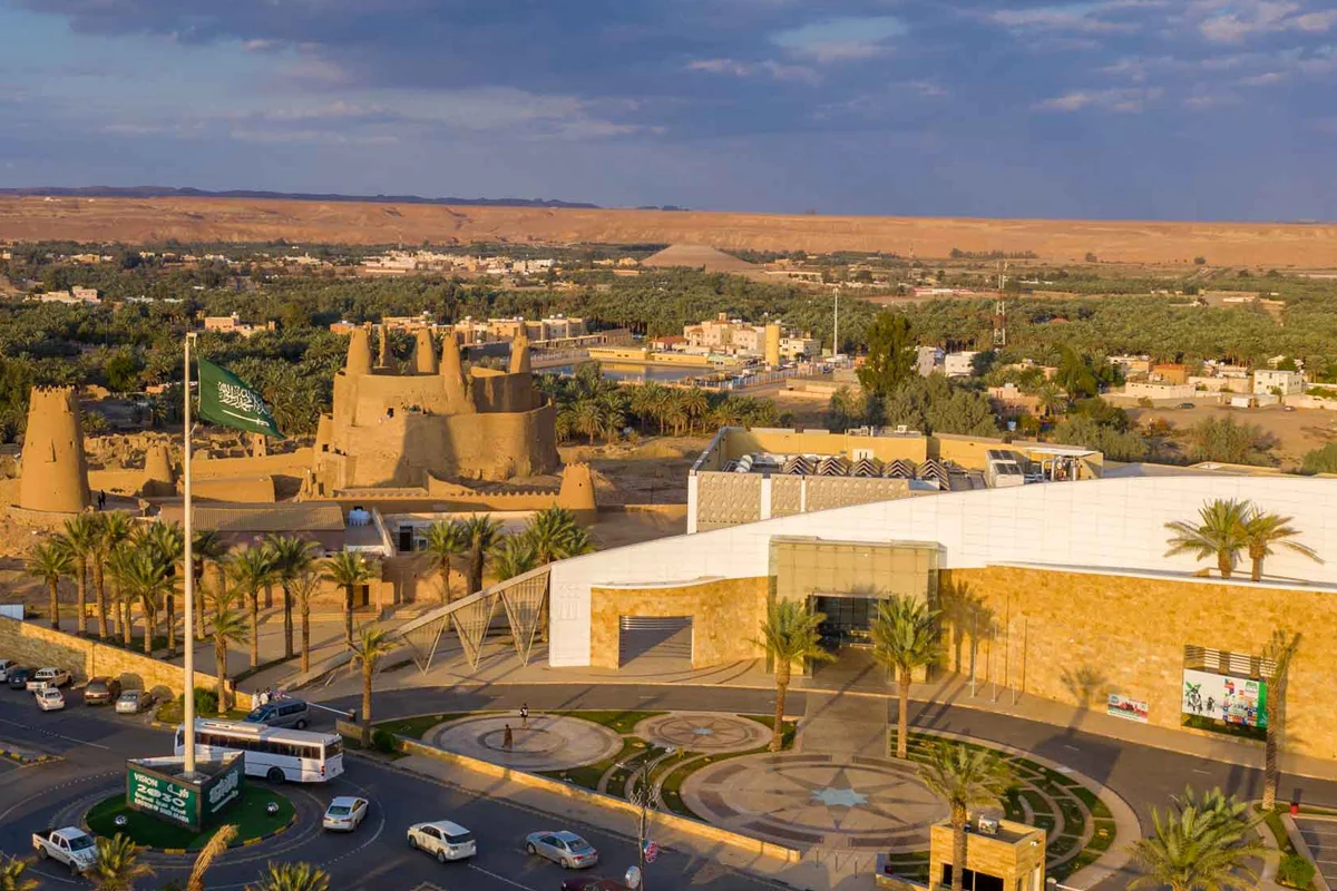
The oasis sits at the southern end of Wadi Sirhan, ringed by low limestone hills, in a broad V-shaped depression roughly 8 by 6 kilometres.
That shape is the point. A depression ringed by limestone collects and holds water underground, recharging the aquifer that fed the oasis. It is a natural cistern the size of a town.
And it sits isolated north of the Nafud desert, at the meeting of major caravan routes.
Water, in isolation, on a crossroads. There is no version of history where that place stays unimportant.
What it did
The oasis played a considerable part in trans-Arabian contact and trade from prehistoric times through to the early Islamic centuries.
Not as a producer of anything in particular. As the place you could survive between two long stretches of nothing.
What the old town was like
Nineteenth-century descriptions give a picture worth having.
The oasis was not one town but a succession of villages close together, each also called a suq. Each village was a cluster of mud-brick houses with flat roofs, and each was surrounded by a large circular enclosing wall.
So imagine a scatter of small walled settlements across a green depression, rather than a single city with gates. That is a completely different mental picture from the one most visitors arrive with.
The wall
At the west end of Dumat al-Jandal stands a defensive wall of mud and stone, about five metres high, dated to the first century AD, built in the same manner as Qasr Marid.
The medieval geographer Yaqut al-Hamawi described Dumah as protected by a fence, with a strong castle called Marid inside it.
That description, written centuries ago, still matches what you can see. Not many places manage that.
Al-Dir'i
The old quarter below the castle is a field of roofless mud-brick houses and narrow lanes.
The detail that stops you: some of these Islamic-period buildings stand on foundations of the mid-first millennium BC.
Somebody in the Islamic centuries built a house on a wall that was already more than a thousand years old, because it was there and it was sound. That is the single most human thing at the site.
The quarter's name is written variously as al-Dir'i, al-Dar'i and al-Dara'. Same place.
What to see, in order
- Qasr Marid first, for the view. It puts the whole depression in front of you.
- The Umar mosque and its minaret, a minute away.
- The old quarter, on foot, slowly.
- The historic market.
- The al-Jawf Regional Museum, which ties the region together.
The oasis was added to ISESCO's Islamic World Heritage List in 2020.
Practical
- Allow a full day, and go in the cooler months if you can.
- Wear real shoes. The old quarter is rubble and drifted earth.
- Do not climb the mud-brick. It is soft, it is old, and it is somebody's heritage.
- Confirm opening arrangements for the castle and museum before you plan around them.
Is visiting part of Hajj or Umrah?
No. Not a rite of either.
Getting there, honestly
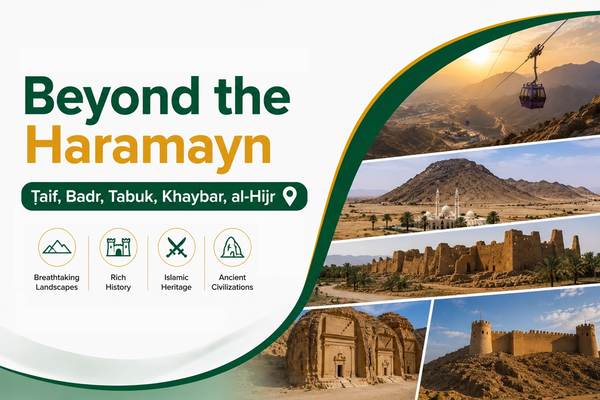
We do not run a scheduled service to al-Jawf and there is no published Wadana Go fare for it. Al-Jawf has a regional airport at Sakaka, and the practical options are flying and hiring a car, or arranging a private car in advance. See driving yourself versus a private driver and renting a car in Saudi Arabia. Our Beyond the Haramayn guide covers ziyarat outside Makkah and Madinah.
Related reading
- Dumat al-Jandal in early Islamic history — the expeditions and the arbitration.
- The Umar mosque — and its remarkable minaret.
- Jawatha — the same pattern at the other end of the country.
- Beyond the Haramayn — the wider ziyarat picture.
Accuracy note
The oasis lies at the southern extremity of Wadi Sirhan, encircled by low limestone hills and forming a large V-shaped depression of approximately 8 by 6 kilometres which favoured the recharge of aquifers, isolated north of the Nafud desert at the intersection of major caravan routes, and it played a considerable role in trans-Arabian contact and trade from prehistoric to early Islamic times; this follows published archaeological reporting on the site. The nineteenth-century description of the oasis as a succession of villages close to one another, each also called a suq, each comprising mud-brick houses with flat roofs surrounded by a large circular enclosing wall, follows the same reporting. The defensive wall at the west end of Dumat al-Jandal, of mud and stone, about five metres high, dated to the first century AD and built in the same manner as Marid Castle, and Yaqut al-Hamawi's description of Dumah as protected by a fence containing a strong castle called Marid, follow published reference sources. That the al-Dir'i quarter contains Islamic-period buildings standing on foundations of the mid-first millennium BC follows published reporting; the quarter's name is transliterated variously as al-Dir'i, al-Dar'i and al-Dara'. The oasis's landmarks include Marid Castle, the Umar ibn al-Khattab Mosque, the al-Dara' district, the historical market and the al-Jawf Regional Museum, and the oasis was listed in ISESCO's Islamic World Heritage List in 2020, per Saudi heritage sources. Opening arrangements at the castle and museum change; confirm before planning around them. Do not climb on mud-brick structures. Visiting is not a rite of Hajj or Umrah. We do not run a scheduled service to al-Jawf and have not quoted a fare. Content verified August 2026. Correction? Tell us.
Frequently asked questions
Planning a Saudi trip?
Pre-book a private car, find a stay, or ask us anything on WhatsApp.
Last updated: 29 August 2026·Sources reviewed by the Wadana Go editorial team.