Al-Bad' Archaeological Site: An Oasis With Layers
Short answer
Al-Bad' sits in Wadi Ifal in coastal Tabuk Region, about 225 km from Tabuk city. It holds Nabataean rock-cut tombs, a Nabataean residential area at al-Malha, the al-Suwaydani well, and Islamic-period remains at al-Malqata dated to the seventh to eleventh centuries. It was a key stop on the Egyptian Hajj route.
Key takeaways
- ✓Al-Bad' lies in Wadi Ifal, about 225 km from Tabuk city and 45 km inland from the Gulf of Aqaba.
- ✓Saudi sources describe it as an oasis for around 3,000 years, most prosperous from about 100 BC to 550 AD.
- ✓Four layers on one piece of ground: the Nabataean tombs, the residential area at al-Malha, the al-Suwaydani well, and Islamic-period al-Malqata.
- ✓Al-Malha proves the tombs were not carved by people passing through. There were Nabataeans living here.
- ✓Al-Malqata's pottery dates to the seventh to eleventh centuries, so the oasis was still building long after the Nabataeans.
- ✓Lihyanite, Nabataean and Islamic inscriptions have all been recorded. Three scripts, three eras, one oasis.
- ✓Al-Bad' was a key stop on the Egyptian Hajj route, the other great overland artery besides the Damascus road.
Quick facts
- Where
- Wadi Ifal, coastal Tabuk Region
- Distance
- About 225 km from Tabuk city
- From the coast
- Around 45 km inland from the Gulf of Aqaba
- Oasis for
- Around 3,000 years
- Prosperous period
- About 100 BC to 550 AD
- Nabataean residential area
- Al-Malha: pottery, foundations, limestone walls
- Islamic-period site
- Al-Malqata: 7th to 11th centuries AD
- Scripts recorded
- Lihyanite, Nabataean and Islamic
- Hajj route
- A key stop on the Egyptian route
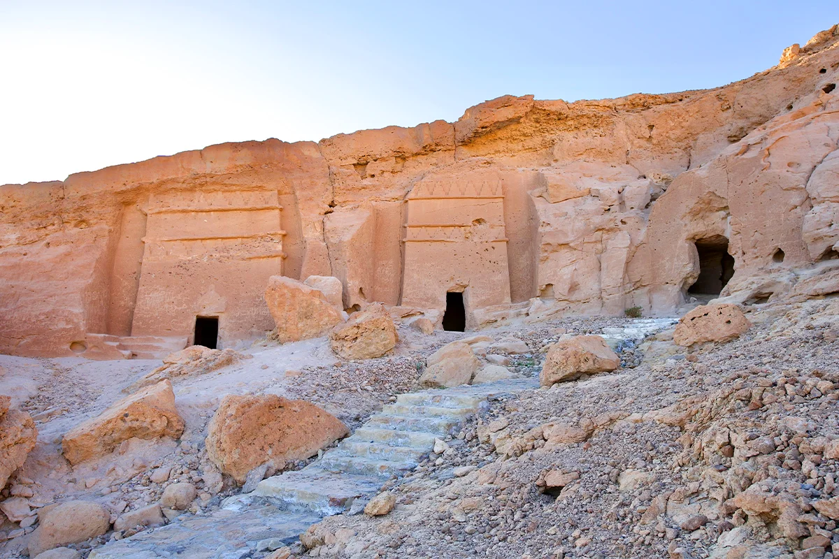
Most people who come to Magha'ir Shu'ayb photograph the carved tombs and leave. The tombs are the smallest part of what is here.
Al-Bad' is an oasis with layers, and the layers are the point.
The place
Al-Bad' sits in Wadi Ifal, in the coastal part of Tabuk Region, overlooking the Gulf of Aqaba and the Red Sea. It is roughly 225 km from Tabuk city and around 45 km inland from the coast.
Saudi sources describe it as having been an oasis for around 3,000 years, with its most prosperous stretch running from about 100 BC to 550 AD.
Water in dry country, near a coast, on a route. That combination is the whole explanation for everything on this page.
What is actually here
Four things, from four periods, on one piece of ground.
The tombs
Rock-cut chambers in sandstone with square plans and single entrances, some with decorated facades and pillars topped with Nabataean crowns. Nabataean, around the first century AD. Covered in detail here.
Al-Malha
A residential area with Nabataean remains: pottery sherds, building foundations and limestone walls.
This is the one people skip, and it is the one that proves the point. The tombs were not carved by travellers passing through. There were people living here.
Al-Suwaydani well
A stone-built Nabataean well, called the Well of Moses in Islamic sources, now mostly destroyed, with the remains of ponds and water channels around it.
Al-Malqata
Islamic-period mounds with brick walls, stone ponds and pottery dated to the seventh to eleventh centuries AD.
So the oasis was still inhabited and still building four to five hundred years after the Nabataeans stopped.
The writing
Lihyanite, Nabataean and Islamic inscriptions have all been recorded at the site.
Three scripts, three eras, one oasis. That is the clearest single statement of what al-Bad' is: not a monument with a date, but a place that people kept coming back to because it had water.
The Egyptian Hajj route
Here is the layer that gets least attention and probably deserves the most.
Al-Bad' was a key stop on the Egyptian Hajj route, the overland road from Egypt to Makkah and Madinah.
Most people know about the Damascus caravan and the forts along it. There were two great overland arteries, not one, and the Egyptian route brought pilgrims from Cairo and everyone who came through Egypt from further west: the Maghreb, and beyond.
They needed the same things the Damascus caravan needed. Water, stores, a safe night. Al-Bad' had water, so al-Bad' was a stop.
The Islamic-period remains at al-Malqata belong to exactly this stretch of history.
Visiting
- Give it half a day, not an hour. If you drive 225 km for twenty minutes of photographs you have wasted the trip.
- Walk the wider site, not just the tomb face. The settlement remains and the water works are what make the tombs make sense.
- Do not enter the tombs or climb.
- Do not pick anything up. Pottery on the ground is data. Leave it where it lies.
- Confirm access first. Arrangements at Saudi heritage sites change, and this is a working archaeological area.
Is visiting part of Hajj or Umrah?
No. Not a rite of either.
Getting there, honestly
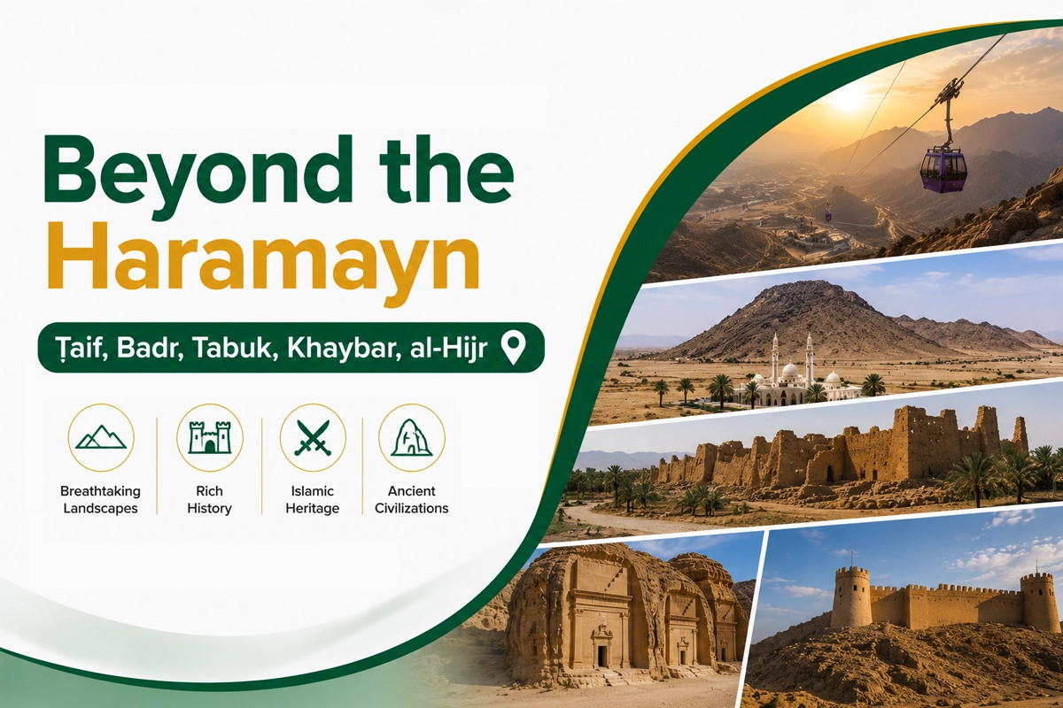
We do not run a scheduled service this far north and there is no published Wadana Go fare for it. Al-Bad' is about 225 km from Tabuk city, so flying to Tabuk and hiring a car, or arranging a private car in advance, are the practical options. See driving yourself versus a private driver and renting a car in Saudi Arabia. Our Beyond the Haramayn guide puts this region alongside Badr, Khaybar, AlUla and Taif.
Related reading
- Madyan and Prophet Shu'ayb — the Qur'an, the ground and the join.
- Magha'ir Shu'ayb — the tombs in detail.
- The well associated with Musa — the tradition, examined.
- Hijr Fort — the other great Hajj road.
Accuracy note
Al-Bad's location in Wadi Ifal in the coastal part of Tabuk Region overlooking the Gulf of Aqaba and the Red Sea, its distance of about 225 km from Tabuk city and around 45 km from the coast, its description as an oasis for roughly 3,000 years with a prosperous period from about 100 BC to 550 AD, and its role as a key stop on the Egyptian Hajj route connecting Egypt to Makkah and Madinah, follow Saudi heritage sources including Saudipedia. The rock-carved tombs in sandstone with square plans and single entrances, facades with terraces and horizontal engravings and entrances with two pillars topped with Nabataean crowns; the residential area at al-Malha with Nabataean pottery sherds, building foundations and limestone walls; the al-Suwaydani stone well, referred to as the Well of Moses in Islamic sources and now mostly destroyed, with remains of ponds and water channels; and the Islamic-period mounds at al-Malqata with brick walls, stone ponds and pottery dated to the seventh to eleventh centuries AD, all follow the same sources. The recording of Lihyanite, Nabataean and Islamic inscriptions at the site is likewise from Saudi heritage sources. The Nabataean dating of the tombs to around the first century AD follows published archaeological study. We have not given excavation dates, protection status or opening hours because we could not verify them; this is a working archaeological area and arrangements change, so confirm access before travelling. Do not remove pottery or other material from the ground. Visiting is not a rite of Hajj or Umrah. We do not run a scheduled service to al-Bad' and have not quoted a fare. Content verified August 2026. Correction? Tell us.
Frequently asked questions
Planning a Saudi trip?
Pre-book a private car, find a stay, or ask us anything on WhatsApp.
Last updated: 31 August 2026·Sources reviewed by the Wadana Go editorial team.